Hello from Ogden by the Salt Lake in Utah.
Today I started soon enough to avoid high winds along the route, but not so early that the temperatures were too close to the dewpoint. What I could not choose is the wind direction, and I had to endure headwinds ranging between 3-16 kt. This made the trip somewhat longer.
Altitudes during today's flights were 6,500, 8,500 and 10,500 ft. Always remember to use Even thousands plus 500 ft. when travelling West. I did cross with 2 airplanes flying in the opposite direction who where also following the same rule but at Odd thousands plus 500 ft since they were flying East. Traffic "No factor" under these circumstances. (Although you still are warned by flight following and want to have the traffic in sight).
Today I could have completed the whole course w/o stopping but it was a stretch for the fuel, particularly considering the changing headwind. So I decided to sop about 2/3 of the way in Rock Springs. Which also helps to stretch the legs and get some warm coffee.
It was cold today, but I could listen to The Eagles and Simon & Garfunkel to keep me warm.
This is how the horizon looked like as I started on the mountains, still in Nebraska. I was thinking about the thousands of pioneers headed West in the old times that may have took these routes....
The plains meet the mountains.....
One of the last high plain farmlands I would see today.
A range of mountains in the foreground and higher snowed capped mountains in the background.
Flying over the first snowed areas.
A beautiful lake in the Laramie river, looking North. The Laramie Fort and town was further South from this picture, and not to be seen.
A selfie in flight including my useful trip companion; Camelbak, always full of fresh water on demand at anytime along the journey.
:-)
This is I-80, the Interstate route that would accompany me for most of the time today.
Just landed at Rock Springs Wyoming. Elevation 6,764. (Density elevation 8,400 said the AWOS). The runway is very long; 10,000.
No Cessnas 172's over here. But N669TW was standing proud among Cirrus, Double engines and Jets.
Fort Bridger Airport on top of a mesa.
To the South the town and the Green River in the distance, with snowed capped high ranges in the far background.
Lake Town and Bear Lake with a big cumulus to the North.
Evanston town and the Bear river.
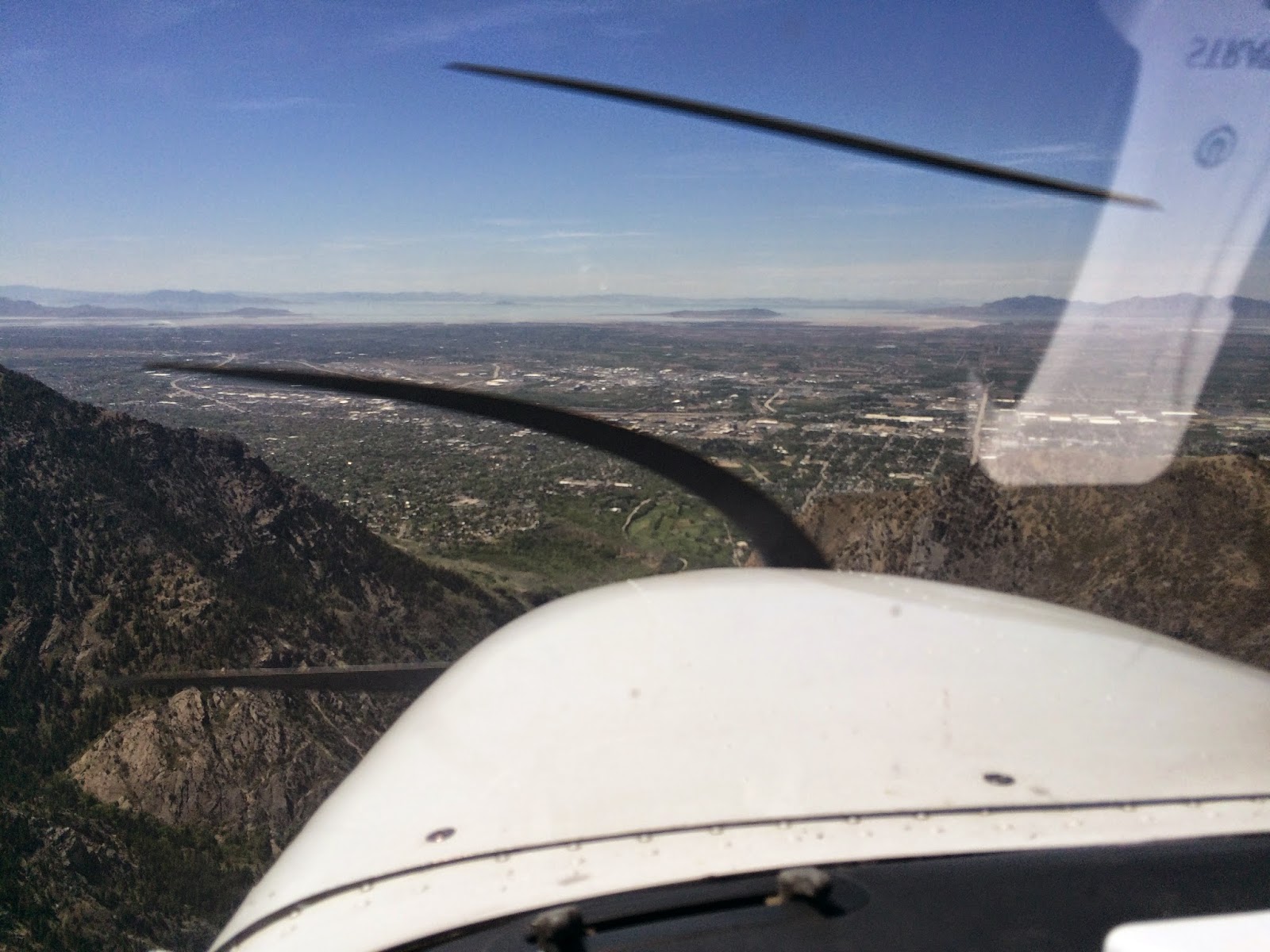
I can already see the Salt Lake in between the mountains ahead. Only one range of mountains between my target and me. In the middle of that range, Ogden Canyon with a "V" shape; my door to the Salt Lake valley.
Into the Ogden Canyon. Looking the South Peak.
Exiting the Ogden Canyon into the valley. The Salt Lake in the distance and the Ogden airport just ahead. Already talking to Tower.
Landing at Ogden. Not much of a cross-wind, about 4-6 kt, but there were occasional gusts of 20 kt.
Landing was not an issue. What was an issue were the taxiways issuing to the FBO parking lots; there were no yellow markings leading to these. And the only markings on the ground led to a Restricted Area. I think these people should spend some yellow paint. It is not that expensive, and may avoid misunderstandings.
Another event worth sharing during the approach; There was a lady practicing take off's and landings at the time I was arriving. Apparently she had been assigned a runway she did not like, and when responding to the tower she kept the mic button pressed and we could all hear her cursing and saying how much she hated that runway and why they assigned that one and not the other one.... and bla, bla, bla and several additional irrelevant chatting. It may have been for no more than 30 seconds until she (realized?) decided to leave the mic button free, but for me, who needed to communicate with the tower, it seemed like an eternity.....
.....Finally I could be announced "Number One and Clear to Land". Phew! (She was number two)
N669TW is done for the day. Here sitting on the tarmac with the Ogden Tower on the left and the freshly snowed mountains in the background.
(By the way, some people asked me how the airplane tail number is called. It is as follows: NOVEMBER-SIX-SIX-NINER-TANGO-WHISKEY). Sorry I only clarify this at this late stage of this trip / blog. On my next adventure I will explain this much earlier.)
This is inside the Mount Valley FBO also known as Kemp Jet Services. I could confirm what I had been told on how well they treat their customers. Before I stopped the plane they were already out in the tarmac helping me with the parking spot. They would also call the hotel and get a good discounted rate and even give you a lift to downtown. I do recommend using them when you fly into Ogden.
Derek from Mount Valley was so kind to give me a lift to the hotel downtown with their car. He also gave me all type of recommendations on where to go around the hotel. This included from good food or a fresh beer, to indoor skydiving, malls and other amenities. Derek is your guy if you want to enjoy Ogden downtown at its fullest. (I need to improve this picture. Sorry Derek)
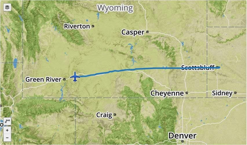
My tracks today:
From Scottsbluff, Nebraska to Rock Springs, Wyoming (KBFF - KRKS)
From Rock Springs, Wyoming to Ogden, Utah (KRKS - KOGD)
Totals for the day:
Scottsbluff to Rock Springs (KBFF - KRKS)
- 256 nm
- 2 hours 56 min
- 140 nm
- 1 hour 48 min
Totals Scottsbluff to Ogden (KBFF - KOGD)
- 396 nm
- 4 hours 44 min
OK, this starts to smell closer to home.
Tomorrow will be another day! You all have a good night.
All the best from Utah,
Eduair ;-)


Say hello to Joseph smith and his many wives
ReplyDeleteDone! It took me a while to talk to all of them.
DeleteHi Eduard,
ReplyDeleteVolar a 3.000m de altura ya tiene valor; debe hacer bastante frio. Las vistas de las montañas nevadas son espectaculares, con el lago al fondo. Supongo que a partir de ahora los terrenos te seran más familiares, sobretodo al acercarte al parque de Yosemite. Creo que has hecho méritos para ser declarado reportero oficial de vuelos coasttocoast. Animos que esto es pan comido. Disfrutalo.
Ignasi from Spain Europe
Ya solo queda la ultima etapa. Lovelock a Palo Alto, y el tiempo pinta bueno...
DeleteVoy a enviar tu blog a callejeros viajeros (versión aire :))))
ReplyDeleteAdelante!
Delete