Thursday, April 30, 2015

All Starts to Feel Familiar Again


Hello. I am in Lovelock! Yes, in Lovelock Nevada a ~2000 inhabitants town in the Nevada high plains, at 3,907 ft.

The most delicate point today was exiting Ogden to the South West. Why? Because there's a big lake (The Salt Lake) and there are plenty of military areas in the vicinity (See pics below). Also the radar showed rain right in my corridor. Later I confirmed that this rain although real it does not reach the ground. It is called "virga". (See pic below)

After that all was about negotiating mountains and the best winds. After 3 days of headwind today I had some tailwind! Not much, but it is always appreciated. I finally landed in Lovelock for the simple reason that it sets me up for a relatively short final leg back to Palo Alto, back home.

As I could experience yesterday Ogden is a city plenty of attractions, confirming what I was told.
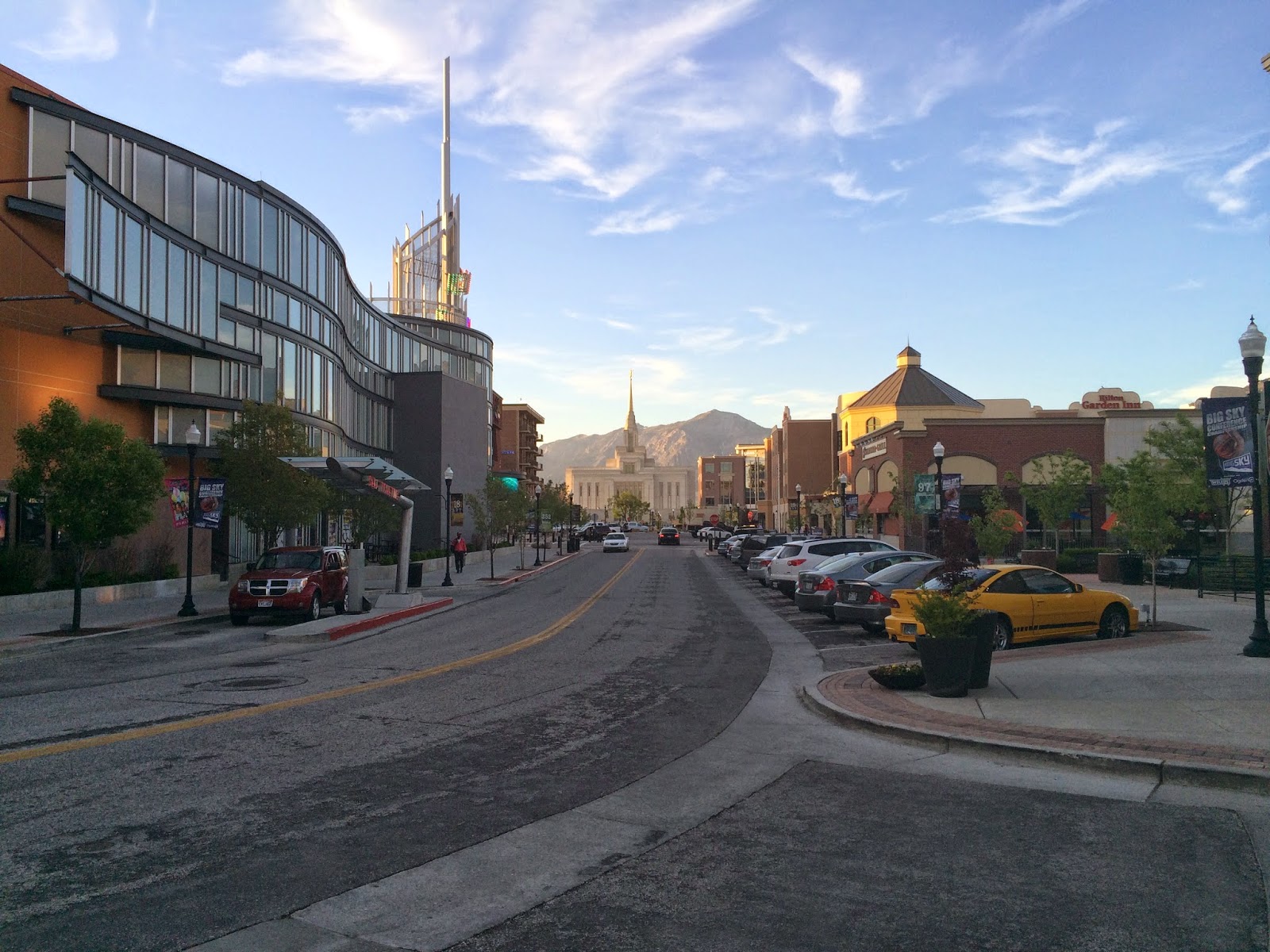
I had a delicious BLT salad with avocado and a Honey beer at Rooster on the 25th, which is a street plenty of cafes and restaurants. Then I had some time to wander around and found among other things two very cool activities; Indoor skydiving and indoor surf (See below).


Town with all the advantages of Salt Lake city but none of the disadvantages of a big city. Good temperatures and snowed mountains in the background.


If you want to attend the Ogden Pioneer Rodeo, you are still on time.
Just reserve some days in July.


Nice walkable avenues with restaurants, cafes and outdoor and indoor activities as the day dies out with warm colors.


There it is: the indoor skydiving place. For $55 you can experience 2 minutes of skydiving in full safety without leaving the earth. (And even needing a parachute)


The pics are not very good, but here you can see some parachute-less skydivers "floating" in this vertical wind tunnel and performing all types of acrobacies.

It was noisy, but very intense. They would not just stay level, they would go up and down and around. Sometimes they would hit the glass walls.


 Here the indoor Surf. Very funny and ingenious! The prices were ~$30 an hour.
What do you prefer? Surf or Skydive?


This is what I was mentioning at the beginning about exiting the Ogden area to the South West. This was my final selected route. Avoiding Class Delta, crossing the lake and heading west parallel to I-80.  As you can see there are 2 areas that say Air Force, and only one corridor in between.


All this is better appreciated in the aeronautical chart below: (Same area but with all the additional aeronautical information)


This is Antelope Island, which is also a State Park. It is worth visiting. I spent some time with Maite and Julia when we last visited the area, and even adventured ourselves in the salty waters on those beaches.


Arriving at the other side of the lake.


Salty and sandy terrain which probably long ago was also covered by water.


This picture has more than it appears; This are the Bonneville Salt Flats. Remember the movie "The world fastest Indian"? by Anthony Hopkins....? .... where he beats the land-speed world record riding a motorcycle?  Well, all this happened here in 1967.  Many other speed records have been attempted and beat since then in these same flats....


These are the cloud producing rain that the radar was detecting. Only that the rain evaporates well before it reaches the ground. This picture is not perfect but we can appreciate this effect.


More clouds with precipitation in the mid distance and vasts extensions of high level desert.


Here I am crossing a range of snowy mountains. Obviously I selected the lower section.


Another range of mountains with snow.


Details of the pass as I fly over it.


For a while I was parallel to this majestic mountain range.


Here we can appreciate the old and the new I-80 routes with a tunnel.


This is the famous S mountain. Unique in the world and part of the known universe.


The selfie of the day.   :-)


Nothing special, just lower mountains as I pass range after range after range....


View on my right side as I head south west and getting closer to my destination today.


Following 3 pictures about how it feels to land at Lovelock (K-LOL) 
No one to be heard on the radio during the traffic announcements. It seems an empty place.


Can you see the runway? 


 Touchdown !  (Very gentle, i promise. Despite the 14 kt with 20 gusts winds)


The Parking lot. Only one airplane, and it is a Cessna-cousin! 


Nobody to greet me but a sign stating all I could find in there. All was true. The door was open, and I could use the pilots room, the restrooms, the telephone to call to one of the recommended Motels on the list with comments and I refueled in the self service, so that the airplane is ready tomorrow morning. 
(Yes, Lovelock airport is also known as Derby Field, and KLOL) 


Nobody around. Literally. So I take another picture with the "tower" and N669TW.


 An airplane that looks like a Mig-3 (?)  No one to tell the story behind this plane...... and I am sure there is one.


By now I am already in my Motel room writing these lines. The owner of the Cadillac Inn came to get me and will bring me back here again tomorrow for a modest fee.


My track today:

From Ogden, Utah to Lovelock, Nevada  (KOGD-KLOL)


The Day Totals:

  • 318 nm
  • 3 hours, 5 minutes 
(Finally a little bit of tailwind!)


Well on my way back home!  Only a 2.5 hours leg away from Palo Alto!  

I can't wait to meet Julia and Maite who have promised to come to the airport.

All the best form Lovelock, Nevada.

Eduair   ;-)


Wednesday, April 29, 2015

In the Middle of the Mountains


Hello from Ogden by the Salt Lake in Utah.

Today I started soon enough to avoid high winds along the route, but not so early that the temperatures were too close to the dewpoint. What I could not choose is the wind direction, and I had to endure headwinds ranging between 3-16 kt. This made the trip somewhat longer.

Altitudes during today's flights were 6,500, 8,500 and 10,500 ft. Always remember to use Even thousands plus 500 ft. when travelling West. I did cross with 2 airplanes flying in the opposite direction who where also following the same rule but at Odd thousands plus 500 ft since they were flying East. Traffic "No factor" under these circumstances. (Although you still are warned by flight following and want to have the traffic in sight).

Today I could have completed the whole course w/o stopping but it was a stretch for the fuel, particularly considering the changing headwind. So I decided to sop about 2/3 of the way in Rock Springs. Which also helps to stretch the legs and get some warm coffee.

It was cold today, but I could listen to The Eagles and Simon & Garfunkel to keep me warm.


This is how the horizon looked like as I started on the mountains, still in Nebraska.  I was thinking about the thousands of pioneers headed West in the old times that may have took these routes....


The plains meet the mountains.....


One of the last high plain farmlands I would see today.


A range of mountains in the foreground and higher snowed capped mountains in the background.


Flying over the first snowed areas.


A beautiful lake in the Laramie river, looking North. The Laramie Fort and town was further South from this picture, and not to be seen.


A selfie in flight including my useful trip companion; Camelbak, always full of fresh water on demand at anytime along the journey.

:-)


This is I-80, the Interstate route that would accompany me for most of the time today.


Just landed at Rock Springs Wyoming. Elevation 6,764. (Density elevation 8,400 said the AWOS). The runway is very long; 10,000. 


No Cessnas 172's over here. But N669TW was standing proud among Cirrus, Double engines and Jets.


Fort Bridger Airport on top of a mesa.


To the South the town and the Green River in the distance, with snowed capped high ranges in the far background.


Lake Town and Bear Lake with a big cumulus to the North.


Evanston town and the Bear river.


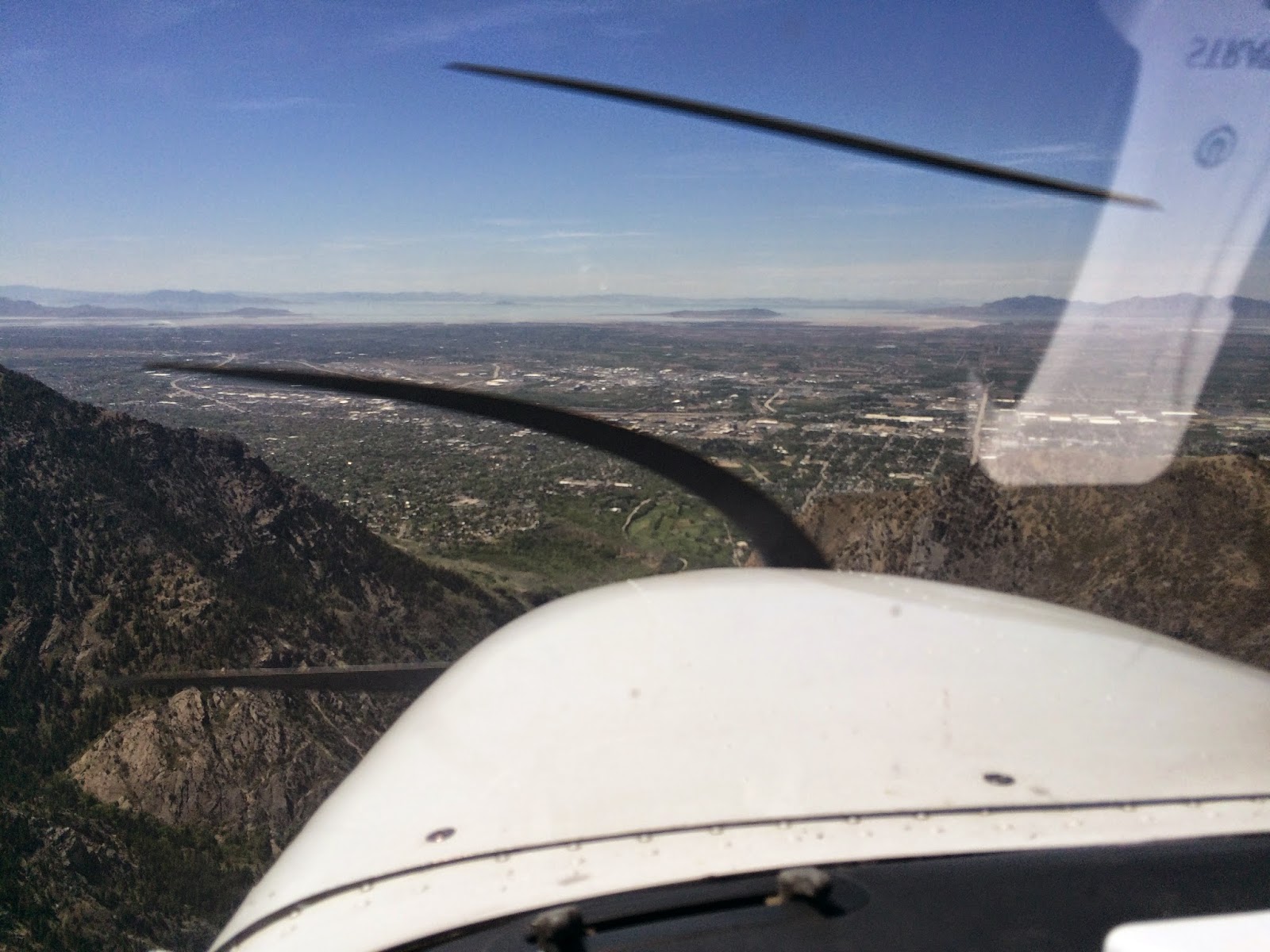
I can already see the Salt Lake in between the mountains ahead. Only one range of mountains between my target and me. In the middle of that range, Ogden Canyon with a "V" shape; my door to the Salt Lake valley.


Into the Ogden Canyon. Looking the South Peak.


Exiting the Ogden Canyon into the valley. The Salt Lake in the distance and the Ogden airport just ahead. Already talking to Tower.


Landing at Ogden. Not much of a cross-wind, about 4-6 kt, but there were occasional gusts of 20 kt.

Landing was not an issue. What was an issue were the taxiways issuing to the FBO parking lots; there were no yellow markings leading to these. And the only markings on the ground led to a Restricted Area.  I think these people should spend some yellow paint. It is not that expensive, and may avoid misunderstandings.

Another event worth sharing during the approach; There was a lady practicing take off's and landings at the time I was arriving. Apparently she had been assigned a runway she did not like, and when responding to the tower she kept the mic button pressed and we could all hear her cursing and saying how much she hated that runway and why they assigned that one and not the other one.... and bla, bla, bla and several additional irrelevant chatting. It may have been for no more than 30 seconds until she (realized?) decided to leave the mic button free, but for me, who needed to communicate with the tower, it seemed like an eternity.....

.....Finally I could be announced "Number One and Clear to Land".  Phew!  (She was number two)


N669TW is done for the day. Here sitting on the tarmac with the Ogden Tower on the left and the freshly snowed mountains in the background.

(By the way, some people asked me how the airplane tail number is called. It is as follows: NOVEMBER-SIX-SIX-NINER-TANGO-WHISKEY). Sorry I only clarify this at this late stage of this trip / blog. On my next adventure I will explain this much earlier.)


This is inside the Mount Valley FBO also known as Kemp Jet Services. I could confirm what I had been told on how well they treat their customers. Before I stopped the plane they were already out in the tarmac helping me with the parking spot. They would also call the hotel and get a good discounted rate and even give you a lift to downtown. I do recommend using them when you fly into Ogden.


Derek from Mount Valley was so kind to give me a lift to the hotel downtown with their car. He also gave me all type of recommendations on where to go around the hotel. This included from good food or a fresh beer, to indoor skydiving, malls and other amenities. Derek is your guy if you want to enjoy Ogden downtown at its fullest. (I need to improve this picture. Sorry Derek)


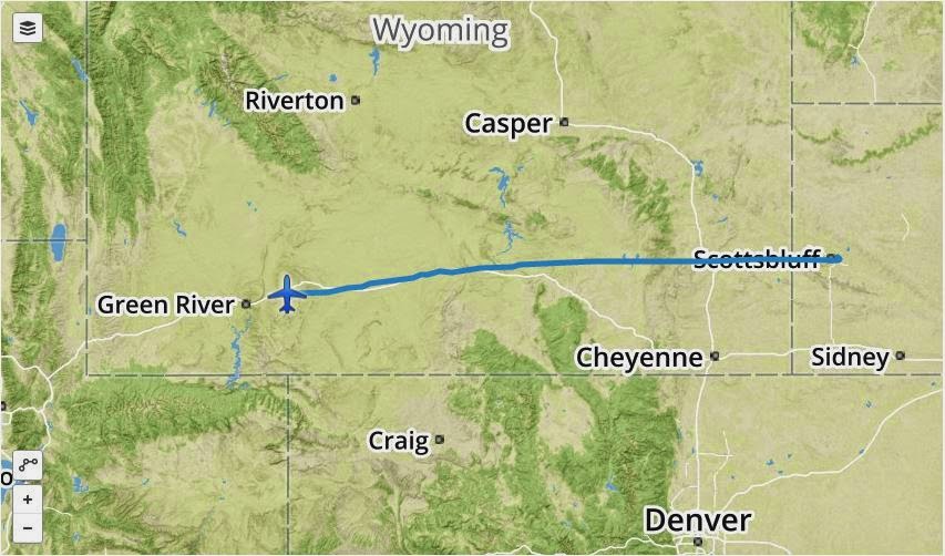
My tracks today:

From Scottsbluff, Nebraska to Rock Springs, Wyoming   (KBFF - KRKS)


From Rock Springs, Wyoming to Ogden, Utah  (KRKS - KOGD)


Totals for the day:

Scottsbluff to Rock Springs (KBFF - KRKS)

  • 256 nm
  • 2 hours 56 min
Rock Springs to Ogden (KRKS - KOGD)

  • 140 nm
  • 1 hour 48 min
Totals Scottsbluff to Ogden  (KBFF - KOGD) 
  • 396 nm
  • 4 hours 44 min

OK, this starts to smell closer to home.  

Tomorrow will be another day!  You all have a good night. 

All the best from Utah,

Eduair   ;-)